 |
Ambassador profile
|
||
| Name: | Roy Dear | |
| Function: | Site Manager for Staatsbosbeheer | |
| Country: | The Netherlands | |
| E-mail: | r.dear(at)staatsbosbeheer(dot)nl | |
| Tel: | +31 65576 5197 | |
Organisation profile
|
||
| Organisation: | Staatsbosbeheer | |
| www: | www.staatsbosbeheer.nl | |
| E-mail: | info(at)staatsbosbeheer(dot)nl | |
| Tel: | +31 57074 7100 (regional office) | |
| Established: | 1899 | |
| Category: | Governmental Organisation | |
| Number of staff: | 900 in total | |
|
| Site profile | |||
| Site name: | Haaksbergerveen | ||
| Location: | Municipality of Haaksbergen, province Overijssel | ||
| Land area: | 600 ha | ||
| Nearest urban settlement: | Haaksbergen | ||
| Natura 2000 ID: | NL9801019: Buurserzand & Haaksbergerveen - site 9 | ||
| www: |
None |
||
| Annual visitor count: | 150,000 - 200,000 | ||
| Majority of visitors from: | Regional area | ||
| Site description: |
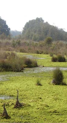
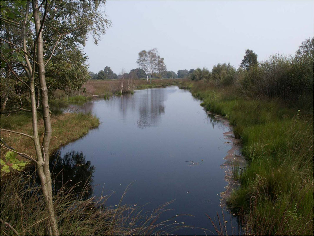
The "Haaksbergerveen" forms the southern part of the habitat area "Buurserzand en Haaksbergerveen" [code: NL980101]. The "Haaksbergerveen" is a relict of one of the raised bog areas on the border of the Netherlands and Germany. The reserve forms a transborder reserve with the "Ammeloër Venn" in Germany [which is also a Natura 2000 area]. After previous degradation, the reserve is now in a restoration phase. During the last few decades a network of dams was constructed in order to restore the necessary water tables to allow the fen-vegetation to recover.
|
|
|
| Priority species | |||
| Species code | Latin name | Common / local name | |
| Misgurnus fossilis | Grote modderkruiper / Weatherfish | ||
| Triturus cristatus | Kamsalamander / Great crested newt | ||
| All habitats (* indicates priority habitats) | ||
| Habitat code | Common / local name | |
| 2310 | Psammofiele heide met Calluna en Genista / Psammofiele heathervegetation with Calluna vulgaris and Genista anglica | |
| 3130 | Oligotrofe tot mesotrofe stilstaande wateren met vegetatie behorend tot de Littorelletalia uniflorae en/of Isoeto-Nanojuncetea / Oligotroph-mesotroph stagnant waters with Littorellion and/or Isoëto-Nanojuncetea | |
| 4010 | Noord-Atlantische vochtige heide met Erica tetralix / ANorth-Atlantic moist heathlandvergetation with Erica tetralix. | |
| 5130 | Juniperus communis - formaties in heide of kalkgrasland / Juniperus communis - formation on heathland or chalk grassland | |
| 7120 | Aangetast hoogveen waar natuurlijke regeneratie nog mogelijk is / Degraded raised bog with possible regeneration | |
| 91DO * | Veenbossen / Bog forest: Birch forest with mosses | |
 |
 |
 |
 |
 |
 |
| Stakeholder profile | |||||
| Stakeholder activity in the management planning process: | |||||
| Stakeholder group | activity level | ||||
| hi ← → nil | |||||
| Local Government | |||||
| Central Government | |||||
| Scientists | |||||
| Private landowners | |||||
| Green NGOs | |||||
| Private sector | |||||
| Private individuals | |||||
| Foresters | |||||
| Farmers | |||||
| Port authorities | |||||
| Anglers | |||||
| Hunters | |||||
| Recreational groups | |||||
| Stakeholder success stories | |
|
Eco-hydrological restoration project Intensive process of stakeholder participation during the preparation and implementation of the project (more details: see below). The stakeholders are satisfied with the approach of the planning and processes used. They are also very happy with the overall outcome of the process. |
|
|
Good relationship with Natuurmonumenten There is a long -standing relationship and frequent contact about management issues with the neighbouring NGO Natuurmonumenten who own the "Buurserzand"area and are in charge of managing that part of the habitat area. |
|
|
Good relationship with Nature clubs There are intensive contacts with IVN (nature education organization) and other local nature-clubs ( e.g. birdwatchers). |
|
| Photo credit: Roy Dear |
| Communication profile | |
| Activities and products for the communication of Natura 2000
|
|
| Events | |
|
|
| Event frequency | |
|
|
| Use of seasonal workers / volunteers | |
|
|
| Kind of work / volunteering opportunities | |
|
|
| Communication literature produced | |
|
|
| Communication target groups | |
|
|
| The organisation has a dedicated communication strategy for Natura 2000 | |
|
|
| Description of communication strategy | |
|
|
| The communication materials are produced | |
|
|
| Site involved in joint working / networking | |
|
|
| Details of joint working / networking activity | |
|
|
| Key site management issues: | |
|
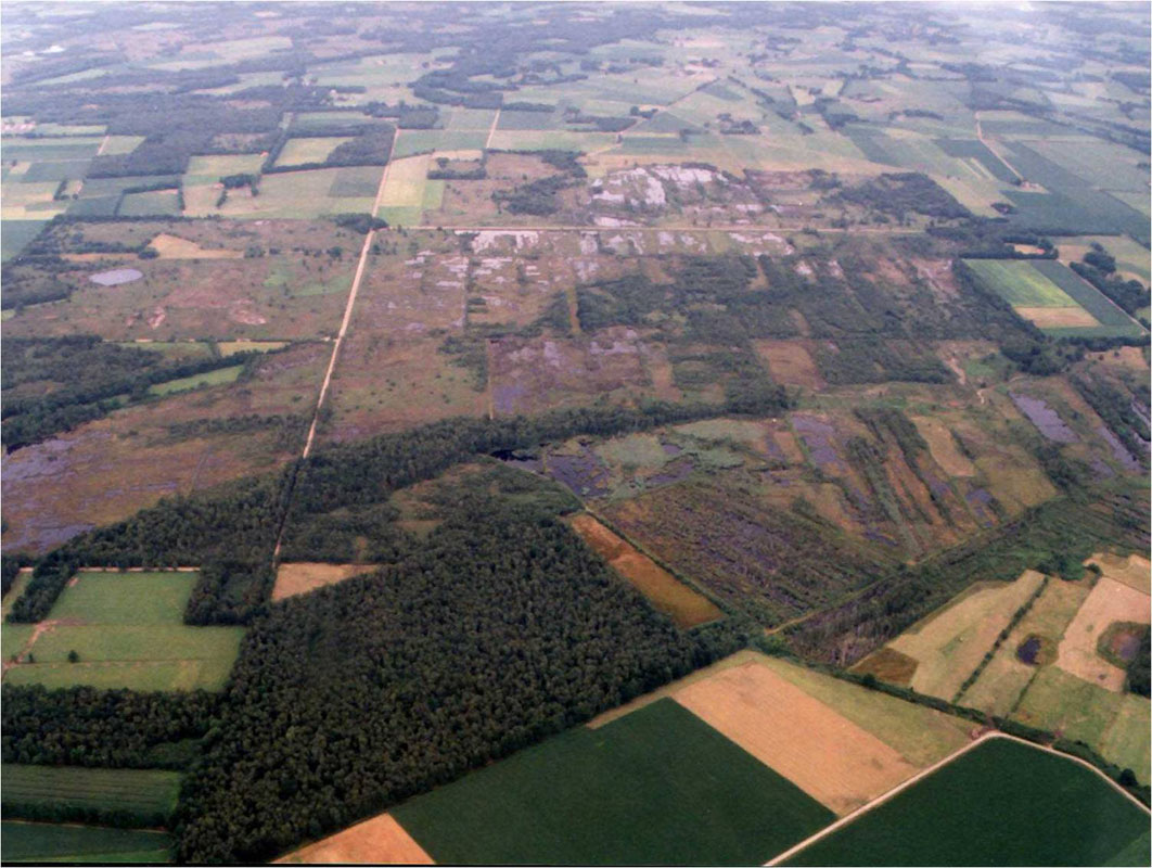
The nature reserve
"Haaksbergerveen" can be found in the borough
Haaksbergen at the border between the province Overijssel and Germany.
This is a beautiful nature reserve, over 600 hectares in size, half
of
which consists of raised bog. As a result of peat cutting, land
re-allotment, improved water drainage in the surroundings and an
enrichment of the soil, these areas became increasingly dessicated.
The
decreasing bog was extremely threatened and could have been lost forever.
In the late 1960's, the tide changed. From 1969 on, restoration work
has
been carried out with the aim to restore the growth of the sphagnum.
Over
the years the Haaksbergerveen has become one of the few locations were
the
growth of Sphagnum is possible. Raised bogs are scarce in the Netherlands
and should therefore be protected and sustained.
|
|
| Integration of Natura 2000 in overall site management: | |
|
The management is aimed at the conservation and restoration of the described habitat types of the reserve.
|
|
| Key site management objectives: | |
|
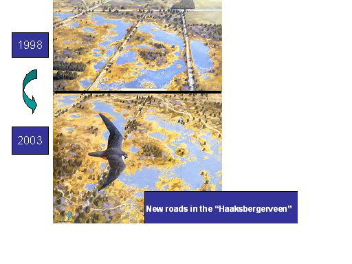
In order to balance
the recreational and ecological functions, Staatsbosbeheer has worked
intensively together with neighbours, local authorities and organisations
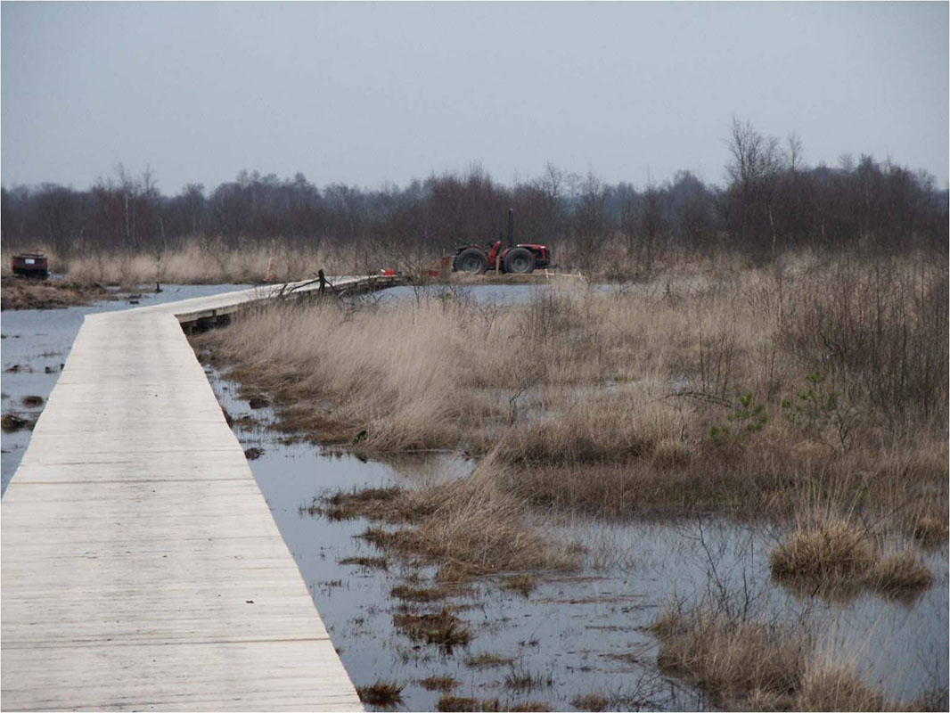
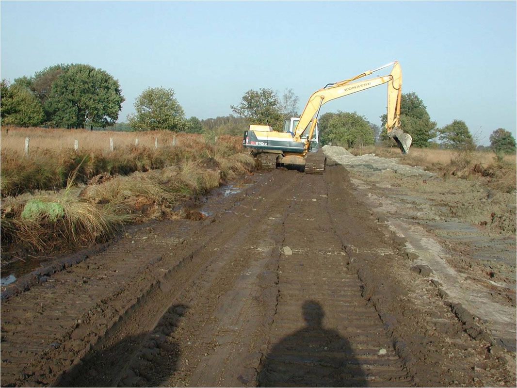
in the region. An eco-hydrological survey showed that the bog-system was still leaking due to the presence of ditches along exploitation roads. It was therefore advised to remove these roads and ditches in order to preserve and stabilize the water tables in different departments of the reserve. As this would have a great impact on the infrastructure of the reserve, Staatsbosbeheer decided to start a process of stakeholder participation.
|
|
| Stakeholders targeted as part of management action: | |
|
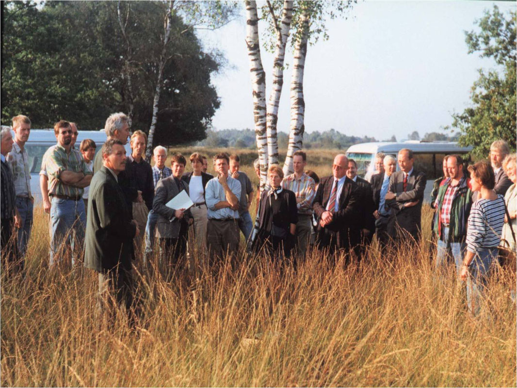
Process of participation
of stakeholders. Therefore the first
step was the production of a brochure, which aimed to get the interest
of the people and to gain their involvement in the process. [see attachment
1]. This brochure was presented to the public and the local authorities
during a field-visit.
|
|
| Description of work carried out / methods and methodology: | |
|
Time table:
Measurements in the period 2001-2002 in the field:
|
|
| Results of action and activities: | |
|
|
|
| Indication of budget allocation for these tasks: | |
|
The realization
of the measurements of the restoration-plan 2001 took place in 2002
and has been carried out with funding from the Ministry for Agriculture,
Nature and Food quality (so called: Survival-plan Forest and Nature).
|
|
| Financial overview | |
| European funding: | |
|
Staatsbosbeheer is lead partner or involved in LIFE projects and Interreg- and Leader+ projects.
|
 |